Views of Sorn Village
 Photo William Reynolds |
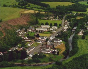 Photo George Smith |
A
different view from a little farther West. looking East up the Main
Street, not easy these days because of the trees, unless you go a little
higher, like George's view on the right. This shot contains some hotspots,
to link to various parts of the village, and show where many of the
long gone areas were. The modern image was taken on July 22nd 2001,
and shows the extent of the recently felled trees, which surrounded
the village for around 70 years. The bank is however being replanted.
Earlier images show an earlier wood. |
One
of the favourite views of Sorn over the decades has been the view from
the Catrine Road, to the South, looking over the whole village. There
were so many shots taken from around the Woodhead area, particularly
in earlier years. This view is much more difficult nowadays, because
of the growth of the trees in the area known as Girvan's wood. |
 Photo - Terry Harrison |
 Photo Chris Lees |
Left
- Sorn around 1870? Some amazing changes between the 1905 shot on the
right and the 1870 shot. Look at the woods at the top of the hill, the
school, row of houses in the middle of the main street etc.
Right - The date on the back of this postcard is 1905! The hi res view of this one is about 211k. Use the scroll bars to see how the village looked around the turn of the century. |
 Photo - Terry Harrison |
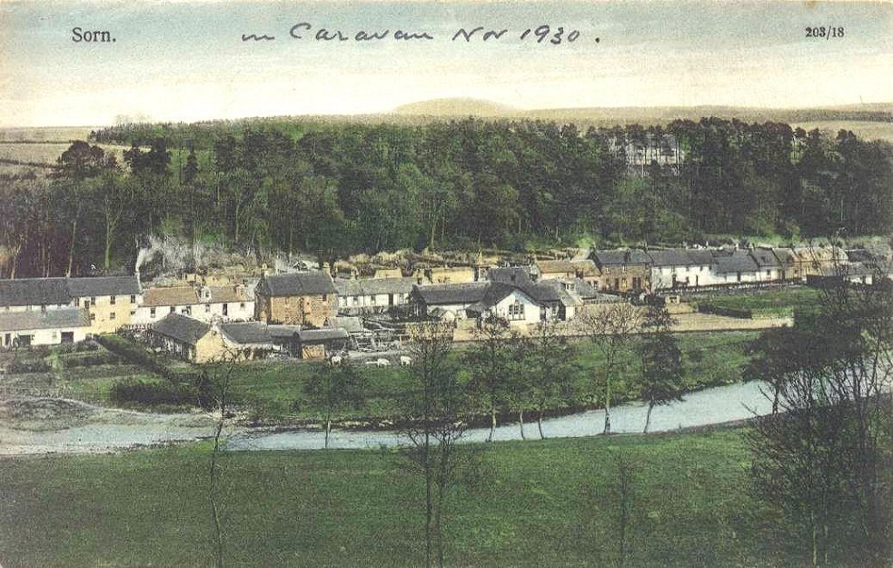 Photo - Library & Info Sce, EAC |
Right - A view from the Catrine Road, coloured in, or in fact only half coloured.
The space behind the trees which is uncoloured, looks like a building, but it is not.
 |
 |

